Feedback form
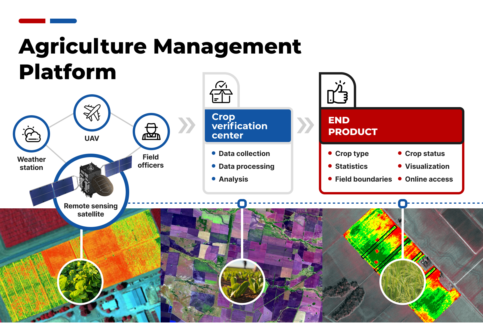
Agriculture Management Platform
Description
Crop fields and types are identified from time-series of satellite data using machine learning based crop identification algorithms built from ground data and expert experiences.Problem
Seed map is an essential tool for farmers that provides not only proper distribution of planting areas but also optimal use of resources. It allows planning of crops in a smart way, taking into account soil features, climate conditions, and other factors that can increase productivity and quality of products. Additionally, seed map can be helpful for analyzing crop results and planning future crop rotations. Therefore, creating a seed map is an important step in ensuring sustainable agriculture development and increasing production efficiency.Solution
Time-series of satellite multispectral images are particularly useful for identifying crops. Seasonality features for each targeted crop are derived from local ground data and expert knowledge, and machine learning algorithms are used to establish the seasonality patterns. The patterns are then applied to time-series NDVI to identify crop types for each field. Finally, fields and their boundaries are detected through the seasonal composition of satellite images. With the help of algorithms, it is now possible to easily identify different types of crops in a field, allowing for more accurate analysis and predictions. This technology also allows for the identification of seasonality patterns, which is a crucial factor in predicting crop yields.Description
Crop fields and types are identified from time-series of satellite data using machine learning based crop identification algorithms built from ground data and expert experiences.Problem
Seed map is an essential tool for farmers that provides not only proper distribution of planting areas but also optimal use of resources. It allows planning of crops in a smart way, taking into account soil features, climate conditions, and other factors that can increase productivity and quality of products. Additionally, seed map can be helpful for analyzing crop results and planning future crop rotations. Therefore, creating a seed map is an important step in ensuring sustainable agriculture development and increasing production efficiency.Solution
Time-series of satellite multispectral images are particularly useful for identifying crops. Seasonality features for each targeted crop are derived from local ground data and expert knowledge, and machine learning algorithms are used to establish the seasonality patterns. The patterns are then applied to time-series NDVI to identify crop types for each field. Finally, fields and their boundaries are detected through the seasonal composition of satellite images. With the help of algorithms, it is now possible to easily identify different types of crops in a field, allowing for more accurate analysis and predictions. This technology also allows for the identification of seasonality patterns, which is a crucial factor in predicting crop yields.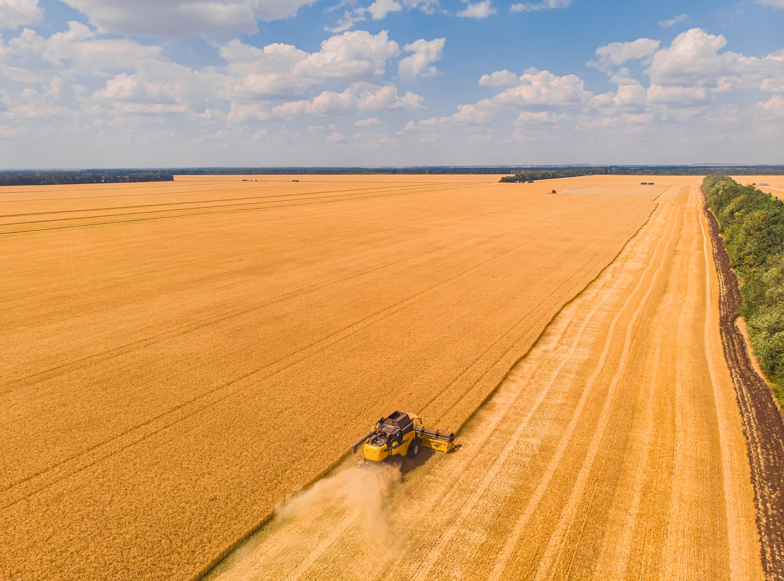
Financial Model
Time to launch the project: 6 months
Payback: 12 months
Interested in the project?
Geography
We have experience in working with clients in more than 20 countries: we understand how local legislation, mentality and experience influence technologies and innovation approaches
Our representations: Bahrain, China, Finland, Germany, Hong Kong, India, Indonesia, Italy, Kazakhstan, Malaysia, Singapore, South Korea, Switzerland, Thailand, Turkey, UAE, USA, Uzbekistan, Vietnam
-
Illicit plants control platform
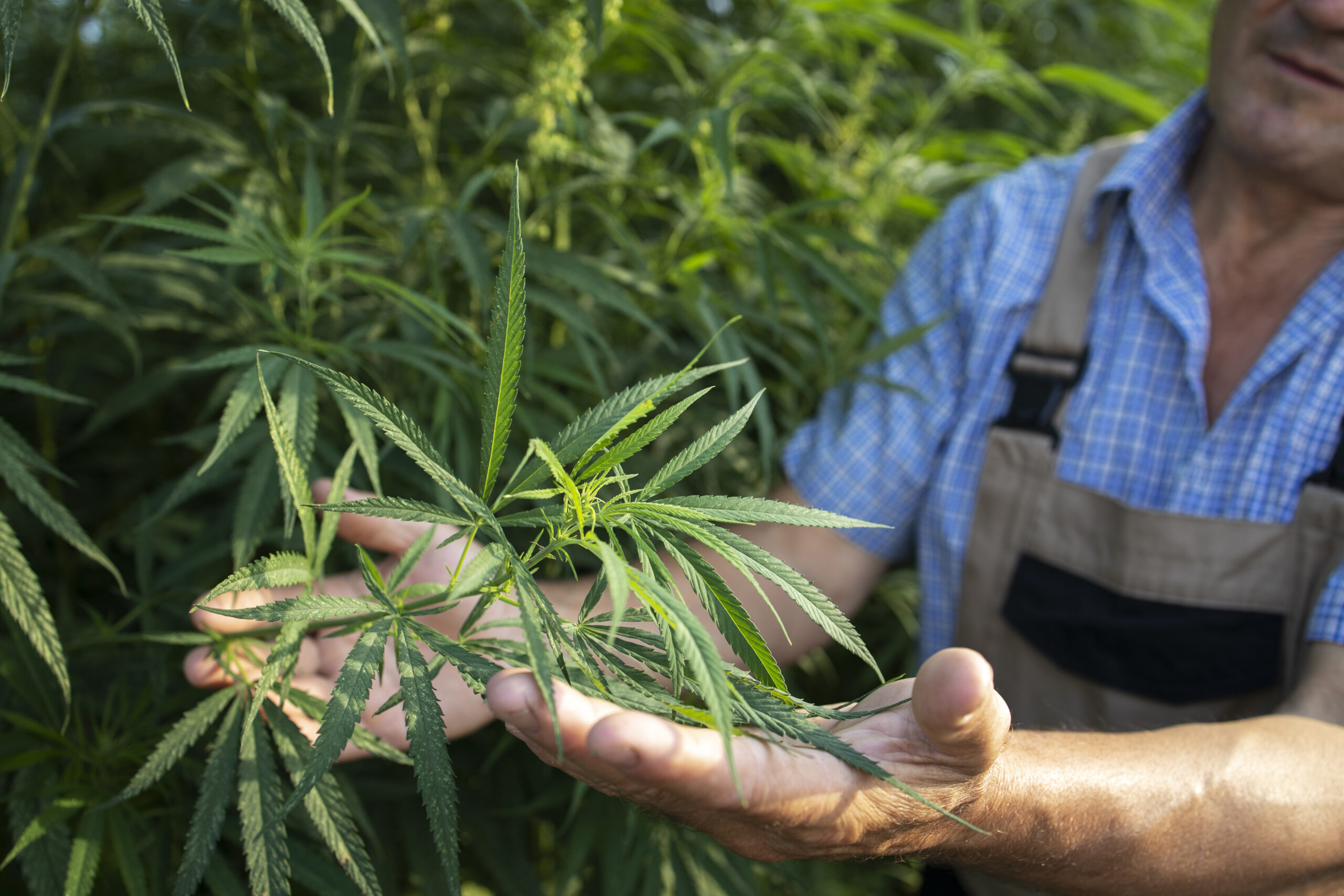
Detection of illicit cannabis plants with the help of spectral cameras mounted on drones to create maps of illegal cannabis plantation
-
Inclusive banking system

The unified mining pool system is designed to provide incentives and rewards to registered users while also preventing any unauthorized mining activities by unregistered miners
-
Waste utilization infrastructure

Waste utilization infrastructure is based on the use of Black Soldier Fly, which consumes organic waste. The output of the technological cycle includes protein flour, saturated fatty acids and biohumus
Other projects
-

National digital transport platform
Improved transport management, such as taxi and flights and passenger control, advanced person identification and simplified visa processing adds to the digital transportation system. Benefits of which are: tourism and counties safety development
-
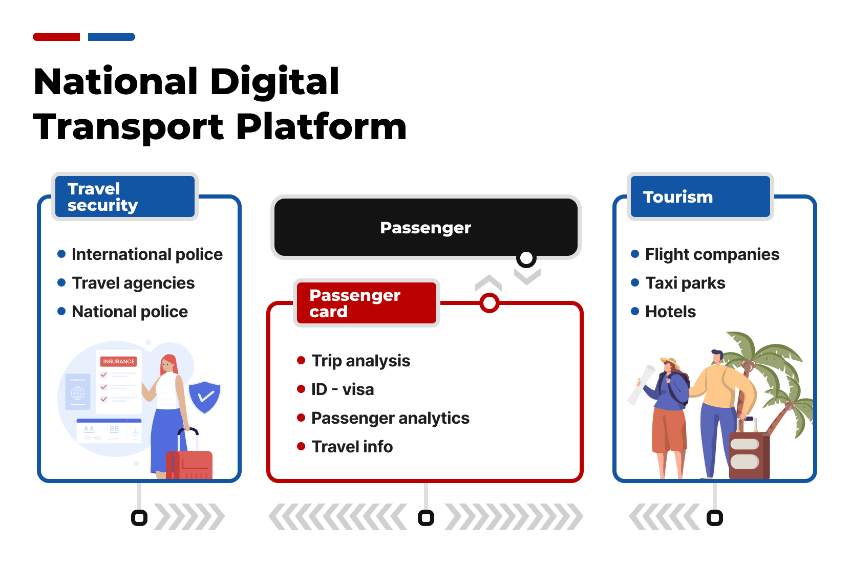
National digital transport platform
Improved transport management, such as taxi and flights and passenger control, advanced person identification and simplified visa processing adds to the digital transportation system. Benefits of which are: tourism and counties safety development
-

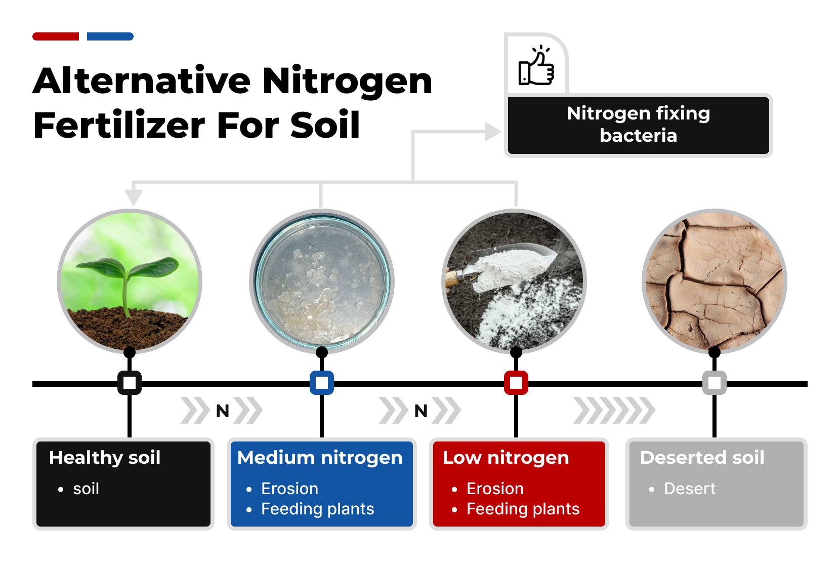
Alternative nitrogen fertilizer for soil
Soil health can be improved by nitrogen fixing bacteria. Nitrogen-fixing bacteria helps to convert atmospheric nitrogen into a form that plants can use
-
Alternative nitrogen fertilizer for soil
Soil health can be improved by nitrogen fixing bacteria. Nitrogen-fixing bacteria helps to convert atmospheric nitrogen into a form that plants can use
-

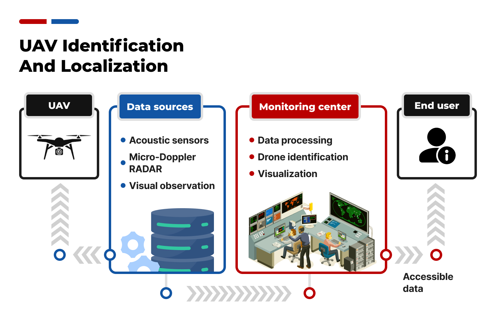
UAV identification and localization
TDOA (Time Difference Of Arrival), also known as multilateration, is a well-established technique for identifying and localizing unmanned aerial vehicles (UAVs)
-
UAV identification and localization
TDOA (Time Difference Of Arrival), also known as multilateration, is a well-established technique for identifying and localizing unmanned aerial vehicles (UAVs)