Feedback form
Monitoring and predictive detection of natural disasters. Earthquake. Landslide. Glacier melting
Description
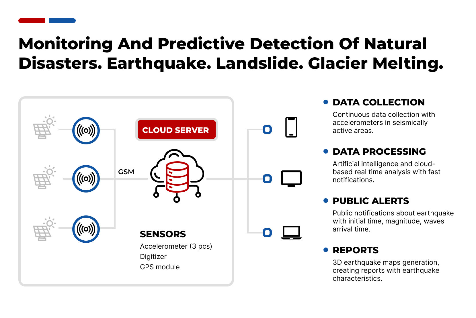
Processing data from satellite images and various sensors via AI in real-time. Forecasting several kinds of natural disasters and informing the population about its affected area, degree of danger, time of effect. Those disasters are as follows: earthquake, landslide and glacier melting.Problem
A natural disaster can cause loss of life or damage property, and typically leaves economic damage in its wake. The severity of the damage depends on the affected population's resilience and on the infrastructure available. It is important for individuals and communities to be aware of the risks associated with disasters, and be able to take steps to prepare for these events. Forecasting of hazard events must be the main concern of specialists.Solution
Collecting data in a surveillance zone using satellite images and, if possible, ground sensors is a critical step in predicting natural and what not disasters. However, processing the huge volumes of obtained data is a challenging task. Real-time use of artificial intelligence allows for more accurate signature processing and quick identification of potential disasters. In addition, It is important to alert the population to potential disasters so that people can take measures to ensure their safety. The alert should contain information about the time of the event, magnitude, and estimated start time of the disaster. Thus, data collection, signature processing, and population alerting are important components in preventing catastrophes and saving lives.Description
Processing data from satellite images and various sensors via AI in real-time. Forecasting several kinds of natural disasters and informing the population about its affected area, degree of danger, time of effect. Those disasters are as follows: earthquake, landslide and glacier melting.Problem
A natural disaster can cause loss of life or damage property, and typically leaves economic damage in its wake. The severity of the damage depends on the affected population's resilience and on the infrastructure available. It is important for individuals and communities to be aware of the risks associated with disasters, and be able to take steps to prepare for these events. Forecasting of hazard events must be the main concern of specialists.Solution
Collecting data in a surveillance zone using satellite images and, if possible, ground sensors is a critical step in predicting natural and what not disasters. However, processing the huge volumes of obtained data is a challenging task. Real-time use of artificial intelligence allows for more accurate signature processing and quick identification of potential disasters. In addition, It is important to alert the population to potential disasters so that people can take measures to ensure their safety. The alert should contain information about the time of the event, magnitude, and estimated start time of the disaster. Thus, data collection, signature processing, and population alerting are important components in preventing catastrophes and saving lives.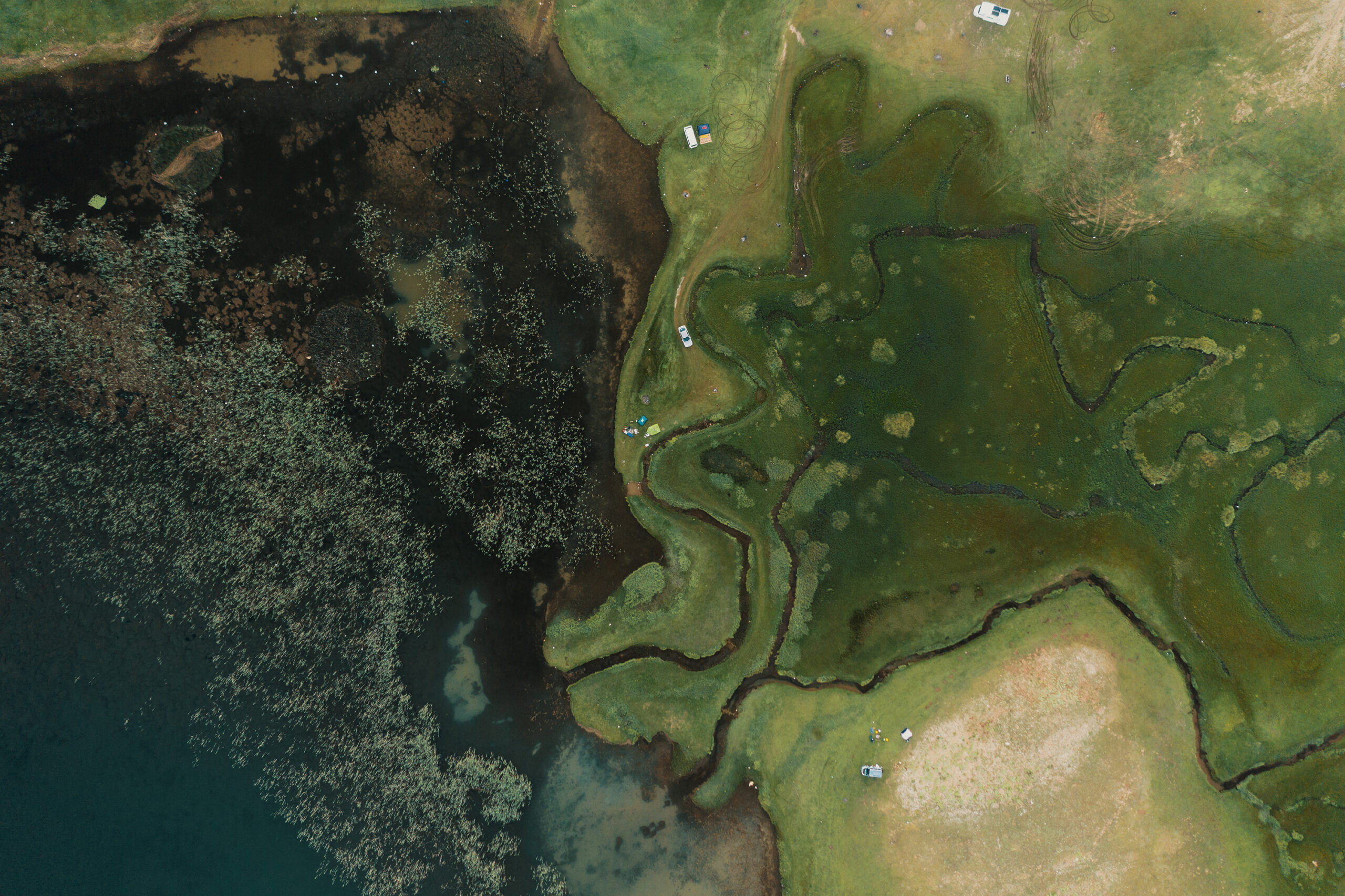
Financial Model
Time to launch the project: 6 months
Payback: 12 months
Interested in the project?
Geography
We have experience in working with clients in more than 20 countries: we understand how local legislation, mentality and experience influence technologies and innovation approaches
Our representations: Bahrain, China, Finland, Germany, Hong Kong, India, Indonesia, Italy, Kazakhstan, Malaysia, Singapore, South Korea, Switzerland, Thailand, Turkey, UAE, USA, Uzbekistan, Vietnam
-
Illicit plants control platform
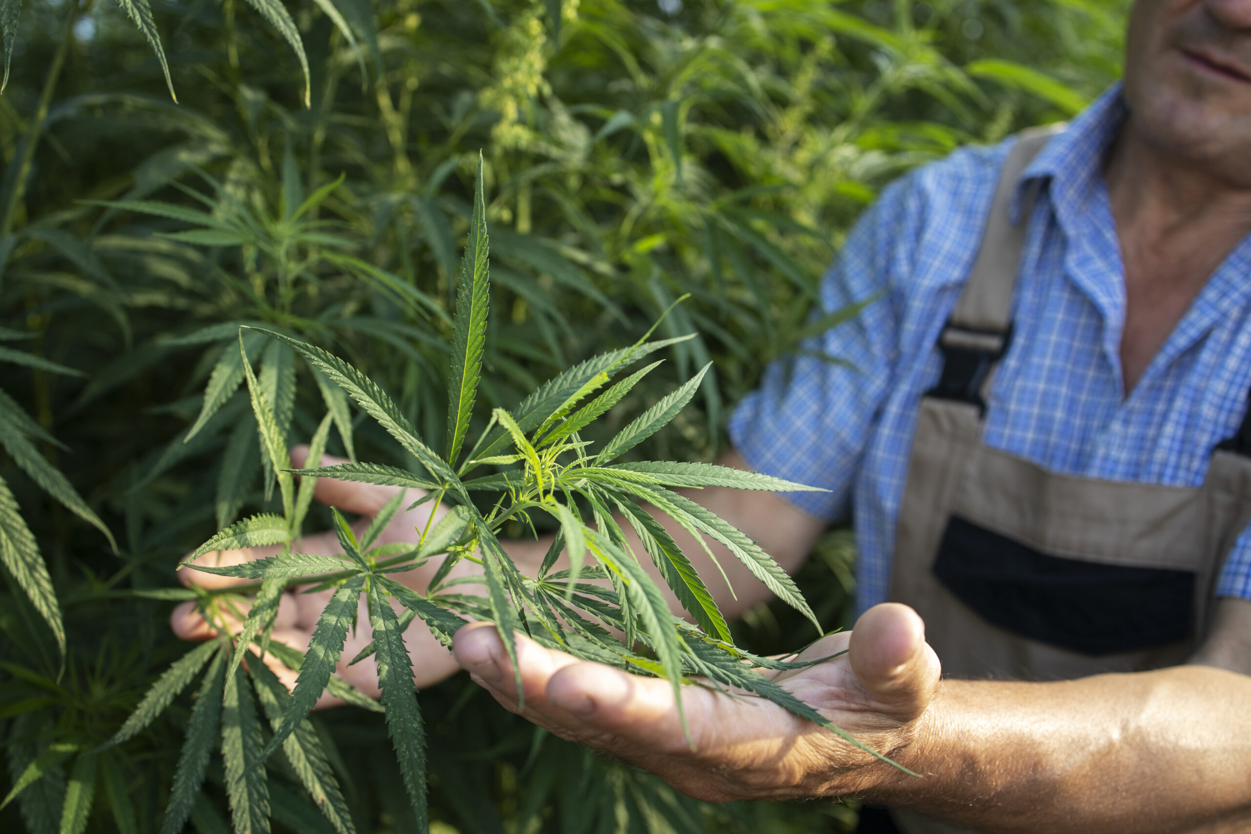
Detection of illicit cannabis plants with the help of spectral cameras mounted on drones to create maps of illegal cannabis plantation
-
Inclusive banking system
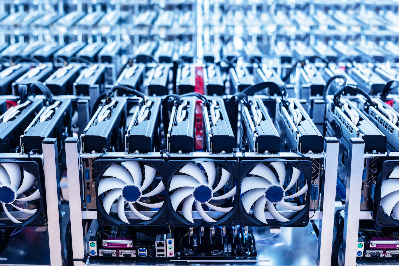
The unified mining pool system is designed to provide incentives and rewards to registered users while also preventing any unauthorized mining activities by unregistered miners
-
Waste utilization infrastructure

Waste utilization infrastructure is based on the use of Black Soldier Fly, which consumes organic waste. The output of the technological cycle includes protein flour, saturated fatty acids and biohumus
Other projects
-

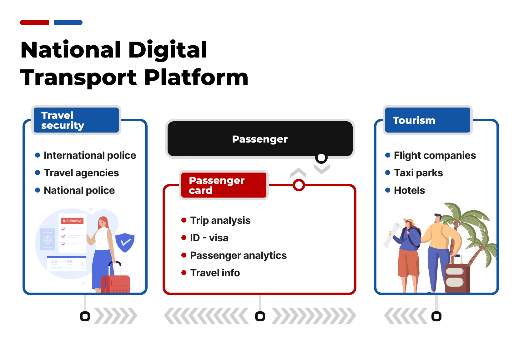
National digital transport platform
Improved transport management, such as taxi and flights and passenger control, advanced person identification and simplified visa processing adds to the digital transportation system. Benefits of which are: tourism and counties safety development
-
National digital transport platform
Improved transport management, such as taxi and flights and passenger control, advanced person identification and simplified visa processing adds to the digital transportation system. Benefits of which are: tourism and counties safety development
-

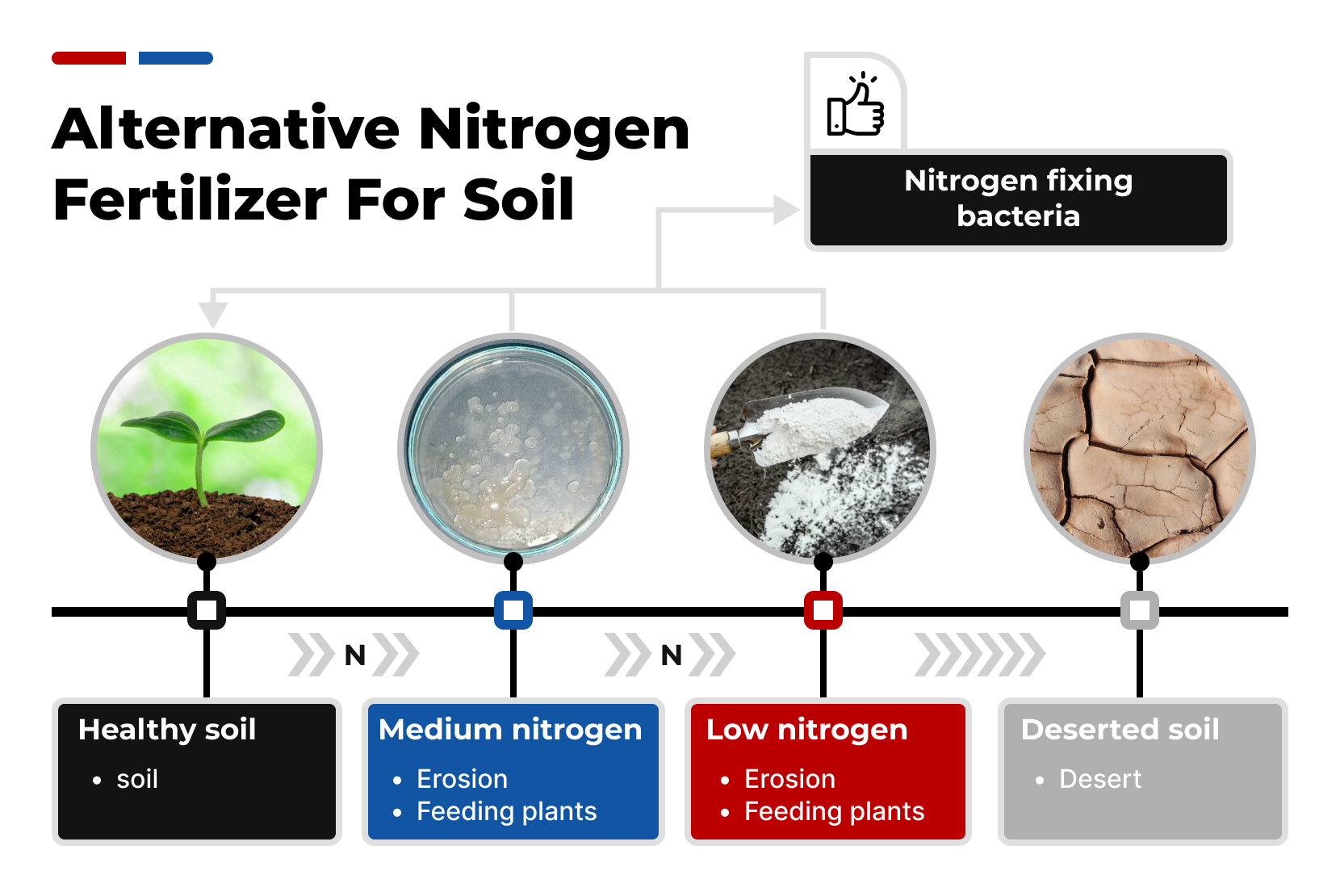
Alternative nitrogen fertilizer for soil
Soil health can be improved by nitrogen fixing bacteria. Nitrogen-fixing bacteria helps to convert atmospheric nitrogen into a form that plants can use
-
Alternative nitrogen fertilizer for soil
Soil health can be improved by nitrogen fixing bacteria. Nitrogen-fixing bacteria helps to convert atmospheric nitrogen into a form that plants can use
-
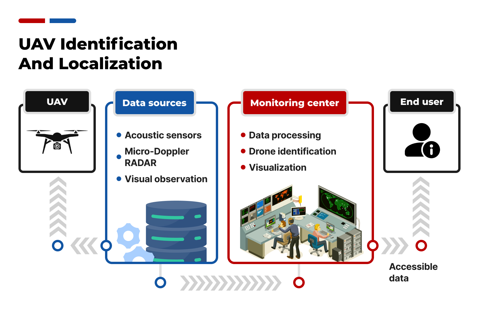
UAV identification and localization
TDOA (Time Difference Of Arrival), also known as multilateration, is a well-established technique for identifying and localizing unmanned aerial vehicles (UAVs)
-
UAV identification and localization
TDOA (Time Difference Of Arrival), also known as multilateration, is a well-established technique for identifying and localizing unmanned aerial vehicles (UAVs)